 |
 © ©
|  |
 |
| Vessel Type: | Armed Passenger Liner | Location: | Co. Antrim |
| Date of Loss: | 27th January 1918 | Place: | Between Rathlin & Mull of Kintyre |
| Cause of Loss: | Torpedoed | Boat Dive from: | Ballycastle |
| Charted Depth: | 123m | Irish O.S. Map: | Discovery Series No. 5 |
| Height of Wreck: | 13m | Admiralty Chart No: | 2798 |
| Hull Material: | Steel | Latitude (GPS): | 55° 25' 40.8" North |
| Type of Seabed: | Sand over clay | Longitude (GPS): | 06° 17' 37.2" West |
| Average Visibility: | 1 - 2m | Convert Lat. & Long. to - | Decimal - CLICK HERE |
| Image available? | Yes - see below | Diving Experience: | Specialist Diving |
| Diving Information: |
|
| Historical Information: |
|
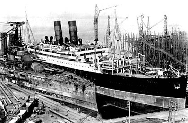 |
© by kind permission of clydeships web site
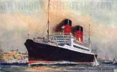
© by kind permission of Børge Solem and Trond Austheim of norway heritage web site
| Source Publications: |
"Dictionary
of Disasters at Sea during the Age of Steam 1824
- 1962 " | by | Charles Hocking |
| London Stamp Exchange 1989 - ISBN: 0948130474 | ||
by | Roy Stokes & Liam Dowling | |
|
"Shipwreck
Index of Ireland" |
by | Richard & Bridget Larn |
| Lloyd's Register - Fairplay Ltd 2002 - ISBN: 1900839970 | ||
|
"Shipwrecks
of the Irish Coast 932 - 1997" |
by | Dr. Edward J. Bourke |
| Edward J. Bourke 1998 - ISBN: 0952302713 | ||
| "Shipwrecks
of the Ulster Coast" |
by | Ian Wilson |
| Impact Printing 1997 - ISBN: 0948154993 | ||
| "The
Harsh Winds of Rathlin" |
by | Tommy Cecil |
| Impact Printing 1990 - ISBN: 0948154659 |
| Other Sources: |
Norman
Woods | - | Internet site (2001) |
|
- | Internet site (2021) |
| |
Last update - 16-Feb-2021
|
|
A page from "www.irishwrecksonline.net" ©