 |
 © ©
|  |
 |
| Vessel Type: | Steam Coaster | Location: | Co. Down |
| Date of Loss: | 26th February 1934 | Place: | Ballyquinton |
| Cause of Loss: | Struck rocks | Boat Dive from: | Portaferry or Strangford |
| Charted Depth: | 30m | Irish O.S. Map: | Discovery Series No. 21 |
| Height of Wreck: | 5m | Admiralty Chart No: | 2093 / 2156 |
| Hull Material: | Steel | Latitude (GPS): | 54° 19' 44.94" North |
| Type of Seabed: | Flat sand and rocks | Longitude (GPS): | 05° 26' 38.94" West |
| Average Visibility: | 3 - 8m | Convert Lat. & Long. to - | Decimal - CLICK HERE |
| Image available? | Yes - see below | Diving Experience: | Experienced |
| Diving Information: |
|
| Historical Information: |
|
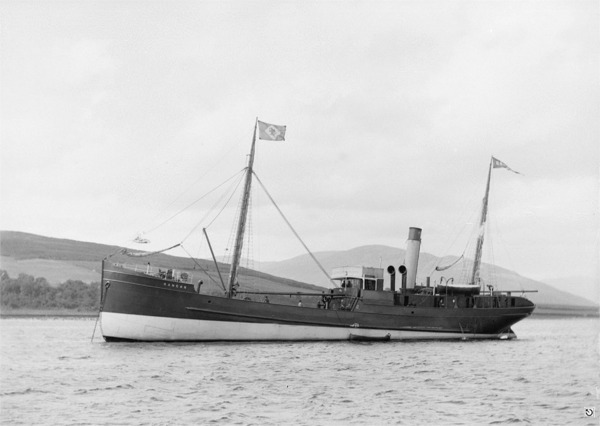
© GB248/DC101/50 Adamson Robertson Collection - Glasgow University Archive Services
Do NOT reproduce without permission
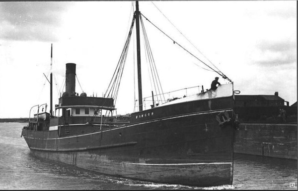
© by kind permission of photoship web site
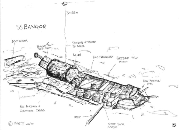
© by kind permission of Michael Montgomery, Castlereagh SAC 2006
| Source Publications: |
| "Cambrian
Coasters" | by | R.S. Fenton |
| World Ship Society 1989 - ISBN: 0905617525 | ||
| "Shipwreck
Index of Ireland" |
by | Richard & Bridget Larn |
| Lloyd's Register - Fairplay Ltd 2002 - ISBN: 1900839970 | ||
| "Underwater
Ireland Guide to Irish Dive Sites" |
by | Irish Underwater Council |
| CFT 1999 - ISBN: 0948283025 |
| Other Sources: |
| Vic
Foster | - | Castlereagh SAC (1996) |
| |
Last update - 06-Dec-2005
|
|
A page from "www.irishwrecksonline.net" ©