 |
 © ©
|  |
 |
| Vessel Type: | Salvage Ship | Location: | Co. Antrim |
| Date of Loss: | 28th September 1921 | Place: | Rathlin Island |
| Cause of Loss: | Struck Rocks | Boat Dive from: | Ballycastle |
| Charted Depth: | 8m | Irish O.S. Map: | Discovery Series No. 5 |
| Height of Wreck: | Scattered | Admiralty Chart No: | 2798 |
| Hull Material: | Steel | Latitude (approx.): | 55° 17' 30" North |
| Type of Seabed: | Boulders and kelp | Longitude (approx.): | 06° 17' 00" West |
| Average Visibility: | 5 - 10m | Convert Lat. & Long. to - | Decimal - CLICK HERE |
| Image available? | Yes - see below | Diving Experience: | Novice |
| Diving Information: |
|
| Historical Information: |
|
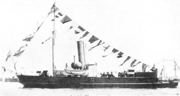
© by kind permission of George Robinson - RIVERSEA web site
| Source Publications: |
by | Roy Stokes & Liam Dowling | |
"Shipwreck
Index of Ireland" | by | Richard & Bridget Larn |
| Lloyd's Register - Fairplay Ltd 2002 - ISBN: 1900839970 | ||
| "Shipwrecks
of the Irish Coast 1105 - 1993" | by | Dr. Edward J. Bourke Edward J. Bourke 1994 - ISBN: 0952302705 |
|
"The
Harsh Winds of Rathlin" | by | Tommy Cecil |
| Impact Printing 1990 - ISBN: 0948154659 |
| Other Sources: |
| Internet 2006 |
| |
Last update - 03-Apr-2006
|
|
A page from "www.irishwrecksonline.net" ©