| |
 © ©
| |
| Vessel
Type: | Motor
Fishing Vessel | Location: | Co.
Galway | | Date
of Loss: | 2007 | Place: | Rossroe
Pier, Killary Bay | | Cause
of Loss: | Broke
from moorings | Boat
Dive from: | Killary |
| Charted
Depth: | 15
- 18m | Irish
O.S. Map: | Discovery
Series No. 37 | | Height
of Wreck: | 6m | Admiralty
Chart No: | 2706 |
| Hull
Material: | Wood | Latitude
(GPS): | 53°
37' 16.44" North | | Type
of Seabed: | Rocks
& silt | Longitude
(GPS): | 09°
51' 27" West | | Average
Visibility: | 10
- 15m | Convert
Lat. & Long.
to - | Decimal
- CLICK
HERE |
| Image
available? | Yes
- see below
| Diving
Experience: | Experienced
Club Diver | - Hull,
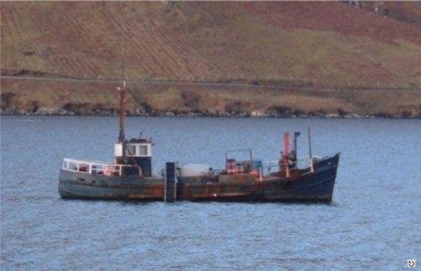
stern to bow, lies in an East to West direction, and she is leaning to Starboard
at 45 degrees in 15 to 18m.
- Take
a bearing North-East from Beacon on corner of Rossroe pier, transecting rocky
point adjacent to pier.
- Wreck
is marked by a Grey Mooring Buoy (furthest from pier of 3 identical buoys) tied
to bow.
- Can be
shore dived easily.
- No
major current.
- Alternatively
boat Launch easily from Rossroe'a new slipway.
- Divers
should also note that Rossroe is a working pier and not to block access.
|
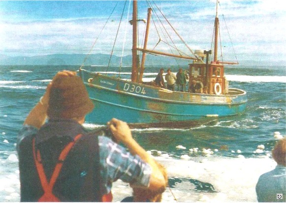
- The
50 foot Rath Connla was built in 1961 by the BIM Boatyard, Dingle, Co Kerry and
her first homeport was Clogherhead, Co. Louth.
- Subsequently
she served in Kilronan, Aran Islands; Cahirciveen, Co. Kerry; Galway, Burtonport,
Cleggan, and finally Killary where she harvested mussels in the Killary Bay area.
- In September
2007 she slipped from her moorings and sank where she became too damaged to refloat.
- She
has become an ideal spot for local divers as an artificial reef.
|
©
by kind permission of Pat
Nolan
©
by kind permission of Pat
Nolan
| | - | Article
by Pat Nolan (July 2008) |
| | James
Keating via email 2008
|
| |
Last
update - 12-Aug-2008

|
|
|