 |
 © ©
|  |
 |
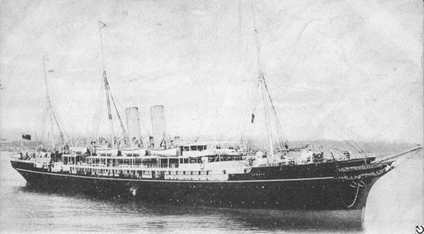
| Vessel Type: | U.S. Armed Merchant Cruiser | Location: | Co. Donegal |
| Date of Loss: | 13th January 1915 | Place: | 15 miles North North-East of Tory Island |
| Cause of Loss: | Mined and sunk | Last known position: | 55° 35' 24" North x 08° 14' 24" West* |
| Source Publications: |
Dictionary
of Disasters at Sea during the Age of Steam 1824 - 1962 | by | Charles Hocking |
| London Stamp Exchange 1989 - ISBN: 0948130474 | ||
Shipwreck
Index of Ireland | by | Richard & Bridget Larn |
| Lloyd's Register - Fairplay Ltd 2002 - ISBN: 1900839970 | ||
Shipwrecks
of the Irish Coast 1105 – 1993 | by | Dr. Edward J. Bourke |
| Edward J. Bourke 1994 - ISBN: 0952302705 |
| Other Sources: |
*source
- Geological Survey of Ireland | - | Internet (2020) |
|
|
Last update - 16-Nov-2020
|
|
A page from "www.irishwrecksonline.net" ©