 |
 © ©
|  |
 |
| Vessel Type: | Fleetwood Fishing Trawler | Location: | Co. Donegal |
| Date of Loss: | 1st January 1946 | Place: | Glengad Head |
| Cause of Loss: | Struck rocks | Boat Dive from: | Bunnagee Pier, Culdaff Bay |
| Charted Depth: | 28m | Irish O.S. Map: | Discovery Series No. 3 |
| Height of Wreck: | Scattered | Admiralty Chart No: | 2811 |
| Hull Material: | Iron | Latitude (GPS): | 55° 18' 27.12" North |
| Type of Seabed: | Longitude (GPS): | 07° 04' 30.84" West | |
| Average Visibility: | 30 - 40m | Convert Lat. & Long. to - | Decimal - CLICK HERE |
| Image available? | Yes - see below | Diving Experience: | Experienced |
| Diving Information: |
|
| Historical Information: |
|
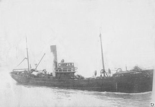
© by kind permission of fleetwood-trawlers web site
Click
HERE
for INFOMAR* Side-Scan image |
Source
Publications:
|
| "Shipwrecks
of the Irish Coast 932 - 1997" |
by | Dr. Edward J. Bourke |
| Edward J. Bourke 1998 - ISBN: 0952302713 | ||
|
"Shipwrecks
of the Irish Coast 1582 - 2000" |
by | Dr. Edward J. Bourke |
| Edward J. Bourke 2000 - ISBN: 0952302721 | ||
| "Underwater
Ireland Guide to Irish Dive Sites" |
by | Irish Underwater Council |
| CFT 1999 - ISBN: 0948283025 |
Other
Sources: |
*source
- Geological Survey of Ireland | - | Internet (2020) |
Article
by Jenny Lawler, UCDSAC | - | SubSea Magazine Winter 2011 |
| |
Last update - 13-Nov-2020
|
|
A page from "www.irishwrecksonline.net" ©