 |
 © ©
|  |
 |
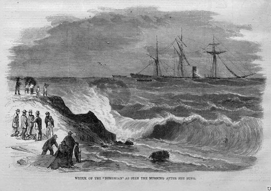
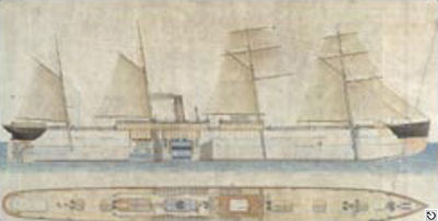
| Vessel Type: | Steamer | Location: | Co. Cork |
| Date of Loss: | 7th February 1881 | Place: | Mizen Head |
| Cause of Loss: | Struck rocks | Boat Dive from: | Crookhaven or Baltimore |
| Charted Depth: | 35m | Irish O.S. Map: | Discovery Series No. 88 & 89 |
| Height of Wreck: | 5m | Admiralty Chart No: | 2129 |
| Hull Material: | Iron | Latitude (approx.): | 51° 27' 00" North |
| Type of Seabed: | Rocks | Longitude (approx.): | 09° 49' 20" West |
| Average Visibility: | 10 - 15m | Convert Lat. & Long. to - | Decimal - CLICK HERE |
| Image available? | Yes - see below | Diving Experience: | Experienced |
| Diving Information: |
|
| Historical Information: |
|

William Moxon Grundy (circa 1876) - Captain of the "S.S. Bohemian"
© by kind permission of Captain Grundy's great grandson, Graham Jackson
© by kind permission of Nick Chipcase at wrecksite web site
© by kind permission of Nick Chipcase at wrecksite web site
| Source Publications: |
| "Dictionary of Disasters at Sea during
the Age of Steam 1824 - 1962" |
by | Charles Hocking |
| London Stamp Exchange 1989 - ISBN: 0948130474 | ||
| "Irish
Wrecks Database" | by | Roy Stokes & Liam Dowling |
|
"Shipwreck
Index of Ireland" |
by | Richard & Bridget Larn |
| Lloyd's Register - Fairplay Ltd 2002 - ISBN: 1900839970 | ||
|
"Shipwrecks
of the Irish Coast 1105 – 1993" |
by | Dr. Edward J. Bourke |
| Edward J. Bourke 1994 - ISBN: 0952302705 |
| Other Sources: |
| Graham
Jackson | - | by Email (2006) |
| Aquaventures |
- | Internet (2001 & 2003) |
| |
Last update - 16-May-2006
|
|
A page from "www.irishwrecksonline.net" ©