 |
 © ©
|  |
 |
| Vessel Type: | Liner | Location: | Co. Cork |
| Date of Loss: | 22nd June 1892 | Place: | Old Kinsale Head, Kinsale |
| Cause of Loss: | Foundered in fog | Boat Dive from: | Kinsale or Courtmacsherry |
| Charted Depth: | 20m | Irish O.S. Map: | Discovery Series No. 87 |
| Height of Wreck: | 4m | Admiralty Chart No: | 2081 and/or 2424 |
| Hull Material: | Iron | Latitude (approx.): | 51° 36' 40" North |
| Type of Seabed: | Rocks and shingle | Longitude (approx.): | 08° 32' 45" West |
| Average Visibility: | 5 - 10m | Convert Lat. & Long. to - | Decimal - CLICK HERE |
| Image available? | Yes - see below | Diving Experience: | Experienced |
| Diving Information: |
|
| Historical Information: |
|
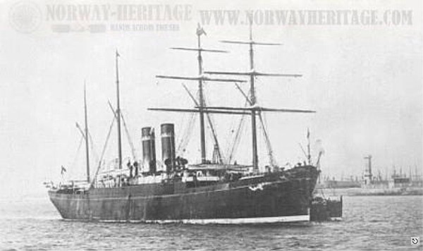
© by kind permission of Børge Solem & Trond Austheim of norway heritage web site
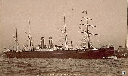
© by kind permission of clydeships web site
| Source Publications: |
| "Irish
Wrecks Database" | by | Roy Stokes & Liam Dowling |
|
"Shipwreck
Index of Ireland" |
by | Richard & Bridget Larn |
| Lloyd's Register - Fairplay Ltd 2002 - ISBN: 1900839970 | ||
| "Shipwrecks
of the Irish Coast 1105 – 1993" |
by | Dr. Edward J. Bourke |
| Edward J. Bourke 1994 - ISBN: 0952302705 | ||
| "Underwater
Ireland Guide to Irish Dive Sites" |
by | Irish Underwater Council |
| CFT 1999 - ISBN: 0948283025 |
| |
Last update - 05-Dec-2005
|
|
A page from "www.irishwrecksonline.net" ©