 |
 © ©
|  |
 |
| Vessel Type: | Motor Coaster | Location: | Co. Down |
| Date of Loss: | 1st January 1942 | Place: | Copeland Islands |
| Cause of Loss: | Ran aground | Boat Dive from: | Groomsport or Bangor |
| Charted Depth: | 23m | Irish O.S. Map: | Discovery Series No. 15 |
| Height of Wreck: | 4m | Admiralty Chart No: | 3709 |
| Hull Material: | Steel | Latitude (GPS): | 54° 40' 38.88" North |
| Type of Seabed: | Rocks and sand | Longitude (GPS): | 05° 30' 38.46" West |
| Average Visibility: | 5 - 10m | Convert Lat. & Long. to - | Decimal - CLICK HERE |
| Image available? | Yes - see below | Diving Experience: | Experienced Novice |
| Diving Information: |
|
| Historical Information: |
|
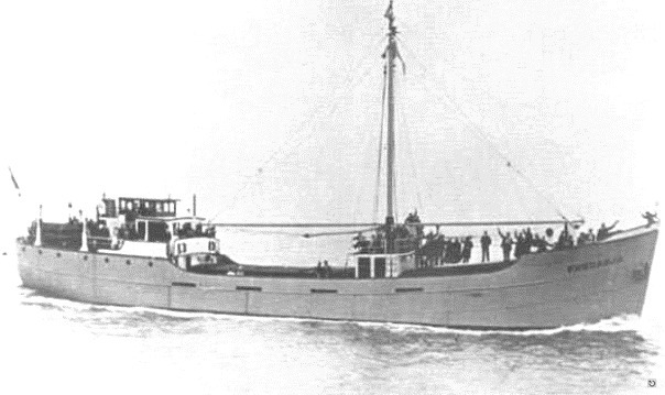
© by kind permission of Willem Vanvoorst web site
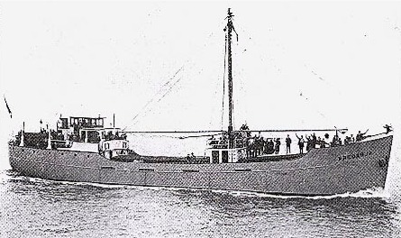
© by kind permission of H. Meurs via Willem Bakema
| Source Publications: |
| "Irish
Wrecks Database" | by | Roy Stokes & Liam Dowling |
|
"Shipwrecks
of the Ulster Coast" |
by | Ian Wilson |
| Impact Printing 1997 - ISBN: 0948154993 |
| Other Sources: |
| Randal
Armstrong | - | Castlereagh SAC (1979) |
| Vic
Foster | - | Castlereagh SAC (1996) |
| Willem
Bakema | - | via email |
|
|
Last update - 21-Mar-2006
|
|
A page from "www.irishwrecksonline.net" ©